Skip to content
SEC

Technology

From field measurement to engineering information

SEC's instruments are the first step of a longer chain: raw observation at one end, engineering information at the other. This page describes that chain — and where each family of technology sits inside it.

Workflow

How the work moves

This is the chain SEC works to. The instruments change with the sector and the scope; the sequence is what the work follows.

  1. 01

    Field acquisition

    Crews and platforms record the site as it is — on the ground, from the air, or over water — under a scope agreed before mobilisation.

    Output Raw field observations, imagery and point measurements

    Instruments Total Stations · UAV Platforms · LiDAR Sensors · 3D Laser Scanners · Electromagnetic Locators · Ground Penetrating Radar · Waterborne Survey Systems · Sonar Imaging Systems

  2. 02

    Positioning

    Observations are tied to a reference frame stated with the deliverable, so later work on the project has a declared frame to be referred back to.

    Output Survey control and referenced coordinates

    Instruments GNSS Receivers · CORS Reference Stations · Total Stations · Digital Levels

  3. 03

    Processing

    Field data is registered, adjusted and turned into models — point clouds, surfaces, orthomosaics and measured drawings.

    Output Processed models and survey datasets

    Instruments LiDAR Sensors · 3D Laser Scanners · GIS Software

  4. 04

    Engineering information

    Processed data is read against the engineering question the project asked: volumes, clearances, alignments, ground conditions, asset records.

    Output Results reported against the project's question, within the agreed scope

    Instruments Ground Penetrating Radar · GIS Software

  5. 05

    Deliverables

    Results are issued in the formats the client's teams already work in, with the content of each output agreed in advance.

    Output Drawings, models, reports and spatial data

    Instruments GIS Software

Technology families

Technology families

Each family groups a class of instruments and links to the service where that capability is delivered.

GNSS Receivers

A measurement means little until it sits in a known coordinate system. GNSS receivers give field observations the reference frame the project is designed and built in.

Contributes Coordinates for control points and survey detail, and the reference frame that every later processing stage inherits.

CORS Reference Stations

This family covers fixed-monument GNSS reference installations. How such infrastructure is used on a given project, and under what arrangement, is set by the scope agreed with the client.

Contributes A fixed reference of known position, used on a project within the arrangement agreed for it.

UAV Platforms

Ground access is not always practical: live plants, water bodies, active corridors, unstable ground. Where the agreed scope calls for it, the survey is flown rather than walked.

Contributes Imagery and sensor data captured from the air and geo-referenced through onboard positioning.

LiDAR Sensors

Where a surface has to be described as geometry rather than as a photograph, LiDAR records it directly as ranged points rather than deriving it from imagery.

Contributes Point clouds, and the surfaces, sections and quantities worked up from them within the agreed scope.

3D Laser Scanners

Drawings age and as-built records go missing. Scanning records the structure as it stands, so later design, analysis and refurbishment work can be referred to what the survey recorded rather than to what was drawn.

Contributes Registered point clouds and panoramic imagery, and the basis for 3D models and measured drawings.

Total Stations

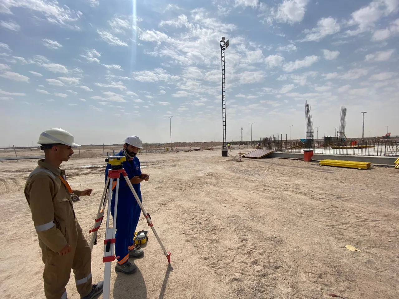
Setting out and as-built checking are done from a known station on the ground. The total station remains the working instrument of engineering survey on an active site.

Contributes Setting-out points, as-built observations and ties between site control and the project frame.

Two field surveyors operating a total station during a land survey at an industrial construction site

Digital Levels

Height is established separately from horizontal position. Levelling sets the vertical control that structures are built to and that repeat monitoring surveys are referenced back to.

Contributes Benchmark heights, and repeat height observations recorded within the scope agreed for the project.

Electromagnetic Locators

This family sits before ground is opened. What a given survey covers, how it is carried out, and how its results are to be read are set by the scope agreed for the project and stated with the deliverable.

Contributes Survey observations recorded in the project's coordinate system and reported within the agreed scope.

Ground Penetrating Radar

Radar equipment records responses along survey lines. Any reading of those records is carried out by the survey team and issued together with the scope it was produced under.

Contributes Radar records and the survey team's reporting, supplied within the agreed survey scope.

Waterborne Survey Systems

Survey over water needs its own instrumentation and positioning arrangement. Which systems are used on a given project is set by the scope agreed for it, and described on the service page.

Contributes Survey observations over water, referenced to the same project control used on land.

Sonar Imaging Systems

Marine survey methods are selected per project. This method is included in the scope only where the project calls for it, and what it covers is described on the linked service page.

Contributes Survey records supplied within the agreed marine survey scope.

GIS Software

A survey ends; an asset record does not. GIS is the family in which captured data is structured and attributed, and in which it can be handed over in a form built to be added to — where the scope provides for that.

Contributes Structured layers, attribute schemas and map or web outputs, issued in the formats the scope specifies.

Services

Technology in our services

The families above are not offerings in themselves. Each one is used inside a service, and this is where each is applied.

Discuss a survey scope

Tell SEC what the project needs to answer, and the team will propose the survey approach and the deliverables that follow from it.